The Lost Flight
- Anish Mehta
- Aug 1, 2025
- 5 min read

“MH370, contact Ho Chi Ming 120.19, good night.”
“Good night, MH370.”
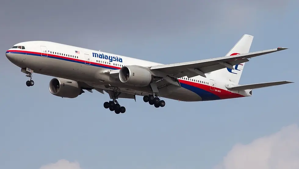
It’s been ten years since that Boeing 777-200ER mysteriously vanished from radar.
In the early hours of Mar. 8, 2014, the world was plunged into disbelief as Malaysia Airlines Flight MH370 vanished without a trace. Departing from Kuala Lumpur International Airport bound for Beijing, the aircraft disappeared, carrying 227 passengers and 12 crew members. The unfolded aerial accident above the South China Sea remains one of modern aviation’s greatest mysteries, prompting an international search effort across vast expanses of ocean.
On Jan. 29, 2015, Azharuddin Abdul Rahman, the director general of the Department of Civil Aviation Malaysia, declared MH370’s status as an “accident.” Despite a thorough investigation spanning from 2014 to 2017, covering 120,000 square kilometers (46,000 square miles) of the seabed approximately 1,800 kilometers (1,100 miles; 970 nautical miles) southwest of Perth, Western Australia, yet no traces of the aircraft were discovered. However, multiple pieces of marine debris were recovered along the coast of Africa and on Indian Ocean islands adjacent to the African coast. Ten years on, the fate of MH370 and the whereabouts of its debris continue to evoke intrigue, leaving the world with unanswered questions and lingering conspiracies.
In 2021, British aerospace expert Richard Godfrey, Dr. Hannes Coetzee, and Prof. Simon Maskell, in a report released on Nov. 30, claimed to have located Malaysia Airlines Flight MH370 using a revolutionary tracking technology called Weak Signal Propagation Reporter (WSPR). In the 232-page report, they asserted that the aircraft crashed in the south Indian Ocean, approximately 1993 kilometers west of Perth, Australia, lying beneath the sea surface at depths exceeding 4000 meters. It’s worth nothing that the exact location is within the area defined by Prof. Pattiaratchi and Prof.Wijeratne of the University of Western Australia in their drift analysis, which was between 28°S and 33°S along the 7th Arc. The crash area is 70nmi by 40nmi or 130 km by 74km and about 46% of the new area has been searched before.
This revelation reignites hope for finding the lost aircraft. Chinese media The Paper contacted experts from the Flight Global Tracking and Surveillance Technology Research Center at the Civil Aviation University of China for this groundbreaking report. Experts told The Paper that the research method did hold credibility, but extensive data support and analysis are required. Whether the precise location of MH370 can be accurately determined hinges on further public analysis of data and detailed procedures by the individuals involved.
WSPR is a software that allows radio enthusiasts to join a global network of low-power propagation beacons, developed by Nobel laureate and Princeton University physicist Joseph Hooton Taylor Jr. Through this software, users can transmit beacon signals from their own radio stations and receive signals from similar stations on amateur radio bands. As these stations receive signals, they upload them to a web server, allowing users to check on reception locations and signal strengths on a map, even displaying the propagation path of the signals.
“The globally established WSPR mechanism is akin to a network of intersecting beacon lines spread across the Earth’s atmosphere. When aircraft traverse certain beacon lines, they cause slight interference to the beacon signal,” The Paper reported. By collecting beacon signals worldwide and stringing together all interference information -- including accurate transmission and reception times, location -- chronologically, and excluding interferences not caused by MH370, the remaining interference information should indicate the aircraft’s presence.
Within the timeframe of MH370’s disappearance, there were hardly any other aircraft in the direction of the southern Indian Ocean. Therefore, within this range, identifying interconnected beacon signals and the locations of weak signal propagation reception and transmission points can preliminarily determine the aircraft’s tracking route.
Godfrey claimed in the report to have identified seven reception and transmission points interfered with by the MH370 aircraft. Thus, connecting these seven points and combining them with the approximate range determined by maritime satellites, drift analysis, and Boeing’s performance data can theoretically lead to a more accurate prediction of the aircraft’s final disappearance point.
Also, it’s worth noting that Boeing’ simulations at the end of the flight has suggested that the Boeing 777 could have potentially glided up to 58 nautical miles (107 kilometers) depending on various factors. On the day that MH370 disappeared from radar, at 00:00 UTC, the surface wind at coordinates 29.128°S 99.934°E recorded a speed of 17.8 knots coming from 150°T, constituting a fresh breeze with waves reaching just over 1.1 meters, featuring elongated waves adorned with numerous whitecaps. A segment of the crash zone depicted in the provided graphic underwent prior scrutiny by Ocean Infinity on May. 10, 2018, with the search width spanning approximately 22 nautical miles on either side of the 7th Arc at that latitude. Given the lack of significant findings from the previous search, Godfrey’s report suggests commencing the new search effort beyond the 22 nautical mile mark from the 7th Arc, targeting areas not previously explored by Ocean Infinity’s autonomous Underwater Vehicles.

As the ten-year anniversary of this doomed flight being around the corner, Malaysian transport minister Anthony Loke pledged to “do everything possible to solve this mystery once and for all” in a public event a few days ago. While details remained scant, Mr. Loke revealed that the Malaysian government had received a promising search proposal from U.S.-based marine robotics company, Ocean Infinity.
“Meaningful changes have been made to prevent a repeat of this tragedy, but I am also clearly aware that the task remains incomplete,” Loke said at commemorative event to mark the disappearance of MH370.
After a decade of uncertainty, could this be the breakthrough that finally unravels the enigma of MH370? At least, for this time, renewed hopes abound as the world watches closely.
____________________________________________________________
Reference
Revolutionary MH370 Tracking Proven Over Short Distances. By Geoffrey Thomas, for Airline Ratings. From https://www.airlineratings.com/news/revolutionary-mh370-tracking-proven-over-short-distances/
MH370 Ground Breaking Report Reveals Location. By Geoffrey Thomas, for Airline Ratings. From https://www.airlineratings.com/news/mh370-ground-breaking-report-reveals-location/
Is Malaysia Airlines MH370 about to be found? This revolutionary tracking technology may make a big difference. By Chen Xi, for Science and Technology Daily and reposted by The Paper. From https://m.thepaper.cn/newsDetail_forward_15716858
Timeline of the search for MH370 – a visual guide. By The Guardian. From https://www.theguardian.com/world/2024/mar/06/mh370-search-timeline-malaysia-airlines-flight-missing-plane-disappearance-visual-guide
Timeline of MH370 disappearance. By CNN. From https://www.cnn.com/2017/01/17/world/asia/malaysia-airlines-flight-370-timeline/index.html
'MH370 radar breakthrough finally shows where doomed plane could be,' says expert. By Saffron Otter, for The Mirror. From https://www.mirror.co.uk/tv/mh370-radar-breakthrough-finally-shows-32283952#google_vignette
10 Years After Flight MH370 Disappeared with 239 on Board, New Investigation Might Bring ‘Some Resolution.’ By Anna Lazarus Caplan, for The People. From https://people.com/new-investigation-missing-flight-mh370-may-provide-some-resolution-families-8604717
Malaysia may renew search for MH370 nearly 10 years after it disappeared. By Ally Barnard and Manveena Suri, for CNN. From https://www.cnn.com/2024/03/04/asia/malaysia-renew-search-missing-plane-mh370-intl/index.html


Comments